The U.S. Geological Survey recorded a 5.8 magnitude earthquake in Mineral, Virginia on August 23, 2011, shaking the eastern seaboard and reminding Gulf Coast engineers that seismic risk extends far beyond California. In New Orleans, the hazard is compounded by 40 to 80 feet of soft Mississippi River alluvium that amplifies ground motion and can lose strength during shaking. This city sits near latitude 29.95°N, where deep Holocene deposits and a water table barely five feet below grade demand a seismic microzonation approach calibrated to ASCE 7-22 and the International Building Code. We run site response analyses that map how much the ground will move at your exact parcel, so foundation design reflects real subsurface behavior rather than generic county-wide coefficients. When a CPT test identifies liquefiable silts below the water table, we integrate those cone resistance profiles directly into the hazard assessment.
Generic ASCE 7 site class maps mask two-second spectral acceleration spikes in soft New Orleans soils; parcel-level microzonation quantifies the difference.
Methodology applied in New Orleans
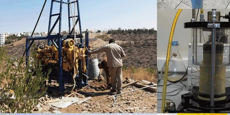
Typical technical challenges in New Orleans
Two parcels separated by only 800 feet in the Lower Garden District can behave completely differently during a seismic event. The block closer to the river often rests on natural levee deposits with slightly higher blow counts, while the block toward Claiborne Avenue sits on backswamp clays with undrained shear strengths below 400 psf. That contrast means site class jumps from D to E, and the code-required base shear can increase by 30 percent or more. Owners who rely on the default site class map miss this granularity. We core and log each boring to the 100-foot datum, run resonant column tests on undisturbed Shelby tube samples, and produce a microzonation map that color-codes amplification factors and liquefaction severity across the entire footprint. When the Louisiana State Uniform Construction Code requires site-specific ground motion procedures for structures in Seismic Design Category C and above, our deliverables satisfy the plan review the first time.
Our services
Every microzonation package we deliver in New Orleans includes the field acquisition, laboratory dynamic testing, and computational modeling needed for a complete submittal.
Site-Specific Ground Motion Hazard Analysis
Probabilistic and deterministic seismic hazard curves for your parcel using the 2018 USGS National Seismic Hazard Model, deaggregated to identify dominant magnitude-distance scenarios that control design spectra.
Liquefaction Triggering and Consequence Assessment
CPT-based cyclic stress ratio evaluation with fines content correction, producing factor of safety contours, LPI mapping, and post-liquefaction settlement and lateral spread estimates for foundation performance design.
Questions and answers
What triggers the requirement for a seismic microzonation study in New Orleans?
When a structure is assigned to Seismic Design Category C, D, E, or F under the IBC, or when the geotechnical baseline investigation identifies Site Class E or F soils, the code requires site-specific ground motion analysis per ASCE 7 Section 11.4.8. In New Orleans, soft soil profiles deeper than 30 feet frequently trigger this requirement for essential facilities, tall buildings, and any project where the structural engineer wants to avoid the conservative default site coefficients.
What does a seismic microzonation study cost for a typical New Orleans project?
For a single-parcel microzonation study in the New Orleans metro area, the fee ranges from US$4,260 to US$17,400 depending on the number of borings, depth of the Vs profile, and whether laboratory dynamic tests are required. A small commercial lot with one CPT sounding and site response analysis falls at the lower end, while a multi-block campus with resonant column testing, two-dimensional basin modeling, and a full liquefaction consequence assessment reaches the upper range.