The saturated alluvium under New Orleans doesn't give up its secrets easily. Between the high water table, interbedded clays, and buried cypress stumps, standard drilling alone can miss critical velocity inversions. That's where seismic tomography earns its keep. Our field crew runs both P-wave refraction and high-resolution reflection spreads to image the contact between recent Holocene deposits and the more competent Pleistocene terrace underneath. You get a continuous two-dimensional velocity model that shows exactly where the soft zones pinch out, which directly feeds the site response analysis required by ASCE 7 for this seismic class. When the exploration depth needs to exceed 100 feet through urban fill in Mid-City or the Warehouse District, we often tie the tomographic profile to a CPT sounding to calibrate the Vs profile with cone resistance data.
A 48-channel tomographic line across a Gentilly site revealed an old distributary channel at 18 feet depth that four borings alone had completely missed.
Methodology applied in New Orleans
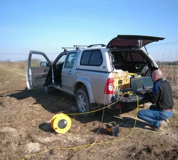
Typical technical challenges in New Orleans
The USGS Quaternary fault map shows the Baton Rouge fault system just northwest of the city, and while New Orleans sits on a passive margin, the deep sediment column can amplify long-period motion from distant events. A seismic tomography survey that stops at 30 feet won't capture the impedance contrast at 80 to 120 feet where the Holocene-Pleistocene boundary often sits. Omitting that deeper velocity information leads to a Vs30 estimate that overestimates the site class, leaving the structural engineer with a seismic base shear that doesn't match the real subsurface conditions. In the CBD and French Quarter, where heavy masonry buildings sit on timber piles that have been exposed to fluctuating groundwater for a century, a reflection profile helps map the pile tip elevation and identify zones where the wood has decayed, reducing the risk of differential settlement during the next 100-year flood event.
Our services
Our New Orleans seismic crew handles the logistics that make urban surveys tricky: permitting for line closures in the Quarter, coordinating with Entergy for clearance near buried lines, and working around the afternoon rain patterns that roll in from the Gulf. These are the two core service packages we deploy across the metro area.
P-Wave Refraction Tomography
Ideal for mapping top-of-rock, rippability, and the thickness of soft alluvium. We run 24- or 48-channel spreads with a sledgehammer or weight-drop source, processing the data through iterative ray tracing to produce a continuous velocity cross-section. The result shows you the lateral extent of low-velocity zones that control settlement and liquefaction susceptibility.
High-Resolution Reflection Profiling
Designed for deeper stratigraphic mapping in the 50-to-300-foot range. We use tighter geophone spacing and a non-explosive accelerated weight drop to generate clean wavelets. The processed stacked section reveals bedding geometry, buried channels, and the Holocene-Pleistocene contact with sub-meter vertical resolution.
Questions and answers
How much does a seismic tomography survey cost for a typical New Orleans lot?
For a standard 48-channel refraction line with full tomographic processing, budgets typically range from US$2,640 to US$4,950 depending on line length, access conditions, and whether we need to combine refraction with reflection. A site with heavy traffic control requirements in the French Quarter will be on the higher end. We provide a fixed-price proposal after reviewing the project plans and site access.
Can you run a seismic line on a paved street or parking lot?
Yes, that's our daily reality in New Orleans. We plant geophones on asphalt or concrete using drill-mounted base plates and a thin layer of coupling gel. The weight-drop source works well on hard surfaces without damaging the pavement. Just let us know if there are brick streets in the Quarter so we bring extra sandbags for source coupling.
What depth can you reach with refraction in the Mississippi River sediments?
In the interbedded clays and silts typical of the delta, the practical rule of thumb is 15% to 20% of the total spread length. A 230-foot line can usually image to about 35 or 45 feet. For deeper targets like the Pleistocene contact at 100-plus feet, we switch to a reflection survey or set up a longer refraction spread with a heavier weight-drop source and lower-frequency geophones.
How do you deal with the high water table and saturated soils?
The reference range for this service in New Orleans is US$2.640 - US$4.950. The final price depends on the project scope and volume.