In New Orleans, anyone who has excavated below five feet knows the drill: you hit groundwater fast, and the soil turns to a gray, organic soup that confuses conventional drilling rigs. Vertical Electrical Sounding cuts through that uncertainty by measuring how subsurface layers resist an injected current—clay, sand, and silty organics each leave a distinct electrical signature. Our team runs VES arrays across sites in Orleans, Jefferson, and St. Bernard parishes where the Pleistocene terrace dips below the Holocene clays, using 4-electrode Schlumberger spreads that reach depths of 100 feet without a single borehole. For projects near the Industrial Canal or out toward New Orleans East, combining resistivity data with CPT logs helps resolve ambiguous transitions between soft deltaic clays and the denser substrata that actually hold a pile.
In the delta, a resistivity profile is less about finding rock and more about mapping where the clay ends—and whether it’s stiff enough to build on.
Methodology applied in New Orleans
Typical technical challenges in New Orleans
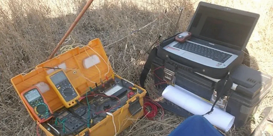
A VES survey in New Orleans runs on a deceptively simple setup: a 12-volt transmitter, four stainless steel stakes, and a resistivity meter packed into a waterproof Pelican case. The real challenge is grounding—dry surface crust in summer or asphalt paving over a neutral ground can add thousands of ohms of contact resistance before the current even reaches the soil. We carry bentonite slurry and copper sulfate electrodes specifically for those high-contact-resistance spots, and we always run reciprocal measurements to filter out the noise from the Entergy distribution grid and the streetcar catenary lines that hum across the city. If a client skips the resistivity step and relies only on boring logs spaced 200 feet apart, they risk missing a buried channel sand that could daylight into an excavation or a pocket of organic peat that will settle differentially under a shallow footing.
Our services
Our resistivity services in the New Orleans metro area cover the full range from pre-design reconnaissance to post-construction forensic work. Each survey includes raw field data, inversion models, and a plain-language interpretation written for the project engineer.
Vertical Electrical Sounding (1D)
Schlumberger array soundings for layer thickness and resistivity beneath a single point. Ideal for foundation investigations at pump stations, tank farms, and levee berms where a quick vertical profile is needed.
2D Resistivity Imaging
Dipole-dipole or Wenner array transects for mapping lateral changes along a line—especially useful along floodwall alignments and canal banks where buried sand lenses or old channel fills can create seepage paths.
Environmental Resistivity Surveys
Plume mapping and landfill delineation surveys using resistivity contrasts to track saline intrusion or leachate migration in the shallow aquifer, following USACE EM 1110-1-1802 guidelines.
Questions and answers
How much does a VES resistivity survey cost for a typical New Orleans lot?
For a standard residential or light commercial lot in the New Orleans area, a Vertical Electrical Sounding survey with three to five soundings and a basic interpretation report runs between US$710 and US$910. The final figure depends on access constraints, number of depth stations, and whether we need to combine VES with 2D lines or supplementary CPT soundings.
Does the high water table in New Orleans affect resistivity readings?
Yes, and it actually helps. Saturated soil conducts current better than dry soil, so the signal penetration improves. The challenge is that brackish pore water in the New Orleans area can mask the resistivity contrast between clay and sand. We correct for this using site-specific water samples and Archie’s Law so the final model reflects lithology, not just salinity.
How deep can you see with VES in the Mississippi River delta sediments?
We routinely reach 80 to 100 feet below grade with a Schlumberger array around New Orleans. The depth of investigation is limited more by the available spread length than by the geology, though highly conductive clays below about 60 feet can attenuate the signal. For targets deeper than 100 feet, we recommend pairing VES with seismic methods.
Can you run resistivity lines under asphalt or concrete in the French Quarter?
Yes, but it requires special electrode placement. We drill small-diameter pilot holes through the pavement and fill them with bentonite gel to couple the electrode to the soil. In the French Quarter and CBD, where we often work on piling projects next to historic structures, this technique lets us collect data without trenching or cutting the street surface.